Thursday, March 19, 2009

Topographic Maps

at
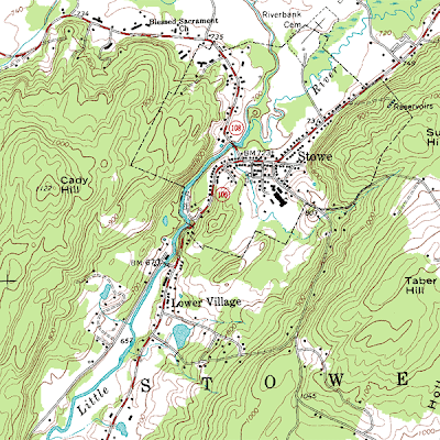
Topographic maps are a certain type of contour maps. They show relief and are typically respesented in large scale detail. This particular map shows elevation for Stowe, Vermont in 20 foot contour intervals. The map also displays various city locations, such as the Lower Village, and bodies of water, such as the Little River. The scale for this map is 1:24,000. The image was taken from http://en.wikipedia.org/wiki/File:Topographic_map_example.png

Planimetric Maps


Planimetric maps are maps that show no relief features. They convey strictly 2D information; therefore, a feature, such as elevation, will never be found on a planimetric map. A common type of planimetric map is a street map. The picture above is an example of a planimetric map of Austin, TX. This map displays roads, landmarks, and bodies of water, but the main purpose of the map is to display major powerlines running throughout the city. It also includes the locations of dams found on the rivers. The map scale or ratio is 1:100,000.