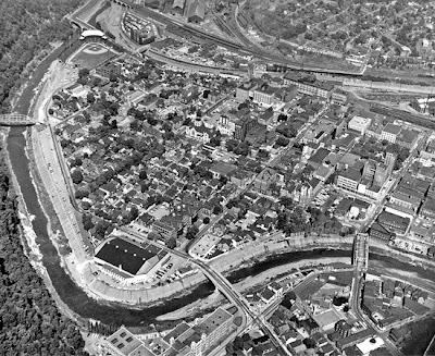
 Black and White aerial photography shows overhead/aerial views of various parts of land and water. These masses emit in wavelengths sensitive to the human eye. This particular aerial photograph is of downtown Johnstown during the 1980s. In this photo, it is possible to view the buildings and their placement and relative heights. Also, it shows where roadways are placed and where trees start and end. It was taken from http://www.jaha.org/edu/flood/rebuild/img/panoramas/1100w/JT_aerial-1950s.jpg
Tuesday, April 7, 2009
Black and White Aerial Photo
 Black and White aerial photography shows overhead/aerial views of various parts of land and water. These masses emit in wavelengths sensitive to the human eye. This particular aerial photograph is of downtown Johnstown during the 1980s. In this photo, it is possible to view the buildings and their placement and relative heights. Also, it shows where roadways are placed and where trees start and end. It was taken from http://www.jaha.org/edu/flood/rebuild/img/panoramas/1100w/JT_aerial-1950s.jpg
Subscribe to:
Post Comments (Atom)
No comments:
Post a Comment