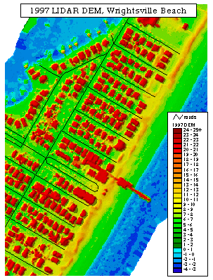
LIDAR is a form of remote sensing. It stands for Light Detection and Ranging. This type of remote sensing employs the use of laser light to help gather images. This is an incredibly accurate technique in measuring elevation of the land. For example, the map pictured above is a Digital Elevation Model (or DEM map) constructed by the use of LIDAR. It shows the elevation of Wrightsville Beach through use of various color scales. However, the key shown on the lower right side does not give a unit for measurement, but I would assume that the elevation is measured in feet. This map was constructed in 1997.
It was taken from http://www.csc.noaa.gov/products/nchaz/htm/intro.htm
No comments:
Post a Comment