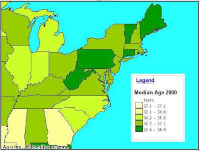
 Thematic maps are used to represent particular aspects of a region. There are many different types or methods of thematic mapping, including chloropeth, isarithmic, dot, and proportional symbols just to name a few. This particular map is a chloropeth map that shows the median age of the population in various states. The color scheme ranges from pale yellow to dark green in order to indicate the ages. This map shows only the northeastern part of the United States.
 This map was taken from http://www.lib.wsc.ma.edu/themap.jpg
No comments:
Post a Comment