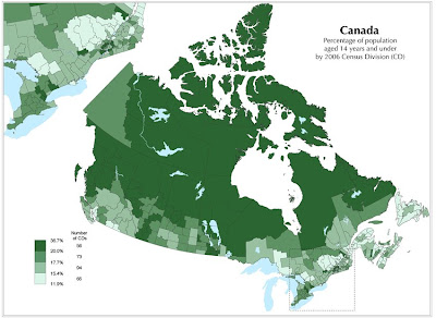
Standardized choropleth maps are maps where the data is areally averaged. Areally averaged data can be presented in many different ways such as densities or percentages. This particular map is an example of a standardized choropleth maps and a classed choropleth map. It shows the percent of the Canadian population under the age of 14. This data was collected from the 2006 Census. This map was taken from http://www.statcan.gc.ca/pub/92f0138m/2008003/figures/5200001-eng.htm.
No comments:
Post a Comment